I was fortunate to attend a recent workshop called Flattening the Globe: The Beauty and Challenge of Flattening Perspectives run by Mariah Landers and Tamar Posner of Math Action at Project Zero’s recent Making, Thinking, Understanding conference in San Francisco, organized by the group CASIE.
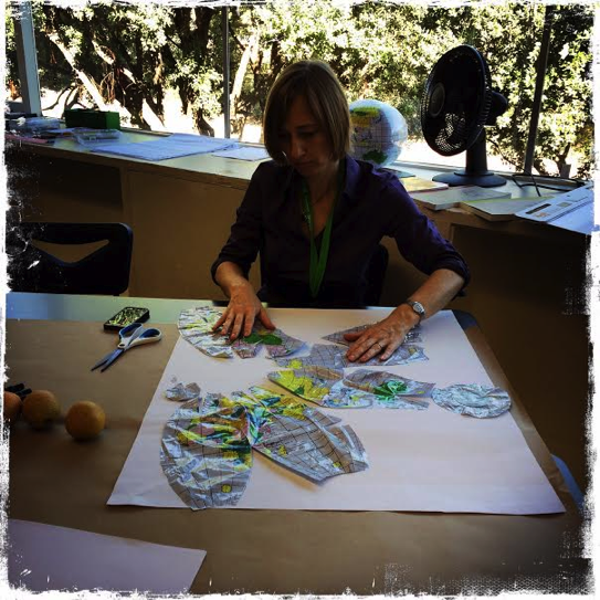
In the picture below you see me hard at work trying to figure out how to reduce the three-dimensionality of a plastic beach ball globe into a two dimensional representation of the world. I can assure you that this task is easier said than done, even in light of a “warm up” activity, which consisted of us trying to flatten the peeled skin of an orange. I initially found myself wanting to cut the beach ball in a way that would keep the continents intact. However, while I managed to keep Antarctica and Australia pretty much as we are used to seeing them, I quickly realized that it would be impossible to avoid chopping up the larger land masses. I ended up snipping through nations in a disturbingly arbitrary fashion, more focused on getting the bulging pieces of plastic to lie flat on the surface of the paper than to represent the world in a coherent or even-handed fashion. I was reminded of the way in which colonial powers carved up Africa, blindly cutting across complex linguistic, ethnic, and social patterns for their own expediency.
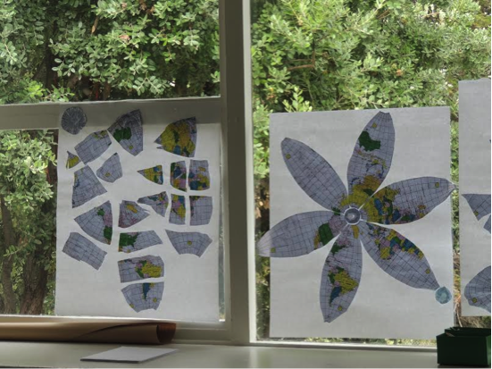
Here is the finished product, which is not going to go mainstream anytime soon.
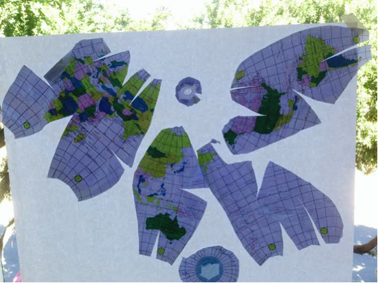
And here are the efforts of a couple of other workshop participants.
Mariah and Tamar’s workshop was intended to open up questions about how math can inform real world issues and perspectives. I will focus here on some connections I saw to Out of Eden Learn, and some questions that were raised for me.
Maps are not straightforward representations of reality
It is incredibly difficult to take something spherical and to flatten it out. Inevitably, compromises have to be made. This rather shrill article Why every world map you’re looking at is WRONG from the British popular press, points to the distorted view of the world that has been perpetuated by the ubiquitous Mercator projection. In this standard representation of the world, Scandinavia looks misleadingly larger than India and North America looks bigger than Africa. Furthermore, the wealthier northern hemisphere conveniently dominates the “top” of the map when it is by no means a given that Argentina, for instance, should be positioned at the “bottom”.
Paul’s Out of Eden Walk is slightly subversive in its representation of the world in that Europe and Africa have been shunted off to the left, leaving the vast swathes of Asia to take center stage. However, this is in no small part a practical decision so that the entirety of Paul’s walk can be summed up on a single page. Paul also uses precise GPS technology in his maproom to show where he has “really” walked in a two dimensional format. In our Out of Eden Learn walking parties we use Google maps, which use an adaptation of the Mercator projection, to connote where participating classes are located.
Nevertheless, in Out of Eden Learn we also encourage young people to create maps of their neighborhoods as seen through their eyes rather than as represented on official maps (our current Footstep 2). In fact, we have had to add explicit instructions that students not turn to Google maps because several students instinctively tried to take that shortcut, missing the very point of the activity. You can see a gallery of student maps in this blog post. Paul in his writing is aware that how people experience the world is often a far cry from officially mapped out versions of reality, even if he cannot exactly recreate how the people he meets construct the world around them. His Walking Jerusalem points to the highly contested ways in which a single space can be conceived, juxtaposing accurate mapping technology with the different meanings and stories that people attach to the city.
How do we as educators strike a balance between using standard representations of the world for convenience’s sake and intentionally drawing attention to the subjective ways in which we experience and represent place – something that can be masked by modern mapping technologies?
Giving people an experiential feel for differences in perspective can be powerful
I loved the highly experiential nature of Mariah and Tamar’s workshop. Trying to represent the whole world on a single piece of paper naturally led to fundamental questions about issues of perspective and who holds power in the world. It was fascinating to debrief with other participants about their experiences of trying to flatten the globe, including how their own biographies and interests helped shape their process. (I have a special affinity for Australia because I used to live there, for example, and I cut around its edges with special care). One participant questioned the way in which maps tend to draw more attention to land than ocean. Another asserted that representations of the world should convey the urgency of safeguarding the environment and earth’s fragility.
Maps can be powerful storytelling devices
I will close this blog post by drawing attention to the potential of maps as storytelling devices. Walking Jerusalem is a prime example of how Paul is experimenting with integrating maps into his story telling. Likewise, in Footstep 2 we encourage students to tell stories related to their neighborhood maps.
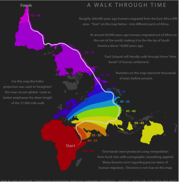
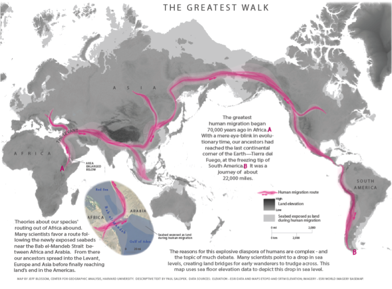
Jeff Blossom of Harvard University’s Center for Geographic Analysis has created some beautiful maps that tell the overarching story of our ancient human ancestors’ migration and how that story relates to Paul’s epic walk: we posted these a while back in our Educator Resources and Forum. The first map “straightens” out Paul’s walk to convey its length, while indicating different phases of human settlement. The second map indicates the broad trajectory of humans’ journey out of Africa, and displays differences in seabed exposures, which made aspects of our great human migration possible at that time. (Click on the images to see them in better detail.)
How might we play around with different scales of storytelling in Out of Eden Learn? And how might we encourage students to explore the potential of maps to tell the kinds of stories they want to tell? We welcome your ideas.